


Ordnance Survey - Sheet 160
Publisher: Ordnance Survey
Format: Paperback
ISBN: none
Ordnance Survey – Sheet 160 (1948)
Ordnance Survey | Fabric-Backed Folded Map | ISBN: None
Condition: Fair – Previously Wall-Pinned, No Cover | Sold by Crappy Old Books
Maps. Those magnificent creations that allow humanity to establish precisely where it is, where it wants to go and how spectacularly wrong things have become in between. Before satellite navigation, smartphones and disembodied electronic voices instructing motorists to turn left into farmyards, there was the Ordnance Survey map: a triumph of British precision, geographical obsession and the reassuring conviction that every road, railway and suspiciously insignificant footpath deserved to be recorded for posterity.
Welcome to Ordnance Survey Sheet 160, a splendid fabric-backed map dating from 1948, when Britain was still recovering from the Second World War, petrol rationing remained a recent inconvenience and the national road network had yet to acquire its modern collection of motorways, bypasses and enormous roundabouts.
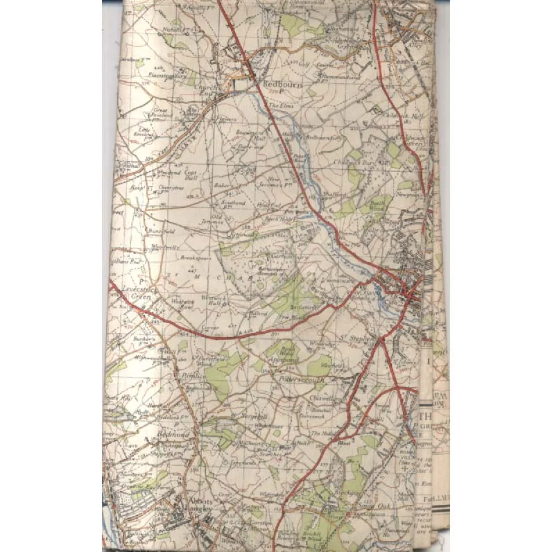
The map depicts part of Hertfordshire and its surrounding landscape, including areas around Redbourn, St Albans, Hemel Hempstead and Abbots Langley. Here, winding roads, railway lines, woodland, villages and scattered farms form a detailed portrait of southern England at a fascinating moment in its history.
And what a moment it was.
Britain was emerging from six years of war, rebuilding its economy and preparing for enormous social and physical transformation. New housing, expanding towns, changing transport networks and the gradual spread of suburban development would reshape much of the landscape during the following decades.
This map preserves a snapshot of the geography before many of those changes occurred, making it particularly interesting to local historians, genealogists and anyone curious about what familiar places looked like before modern development arrived with its bulldozers, planning committees and optimistic promises of improved traffic flow.
The fabric backing is a particularly appealing feature. Unlike ordinary paper maps, which tend to disintegrate after repeated folding, damp weather and enthusiastic handling, cloth-backed maps were designed to endure considerably more punishment. They were practical, durable objects, intended for repeated use rather than merely looking respectable on a bookshelf.
And this example has certainly experienced life beyond the bookshelf.
Previously used as a wall-mounted map, it bears evidence of having been pinned up, suggesting that a former owner found the geography sufficiently important to keep permanently on display. Perhaps it served as a planning aid, a geographical reference or simply a convenient way of deciding where to go on Sunday afternoons. Whatever its original purpose, it has clearly enjoyed a more active existence than many maps that spend decades folded inside forgotten drawers.
The map is offered without its original cover and is in Fair condition, reflecting its age, previous wall display and general use. It is therefore best appreciated as an authentic historical working map rather than an immaculate collector’s specimen.
This 1948 Ordnance Survey Sheet 160, offered by Crappy Old Books, will appeal to collectors of vintage cartography, Hertfordshire local historians, enthusiasts of post-war British geography and anyone who enjoys examining the changing landscape of England.
A wonderfully characterful survivor from the days when maps were made to be used, consulted, folded, unfolded and occasionally nailed to the wall.
And unlike modern satellite navigation, this one has never required charging, updating or an internet connection.
Admittedly, it has also never told anyone they’ve taken the wrong turning.
But judging by the evidence, somebody once thought it was useful enough to pin up permanently.
Which is more commitment than most modern motorists show to their satnav.
Keep browsing: See more Maps books Other books by Ordnance Survey
